|
|
||
|
From Town Hall looking northeast down High Street toward the Castle Large Image |
|||
 |
 |
 |
|
|
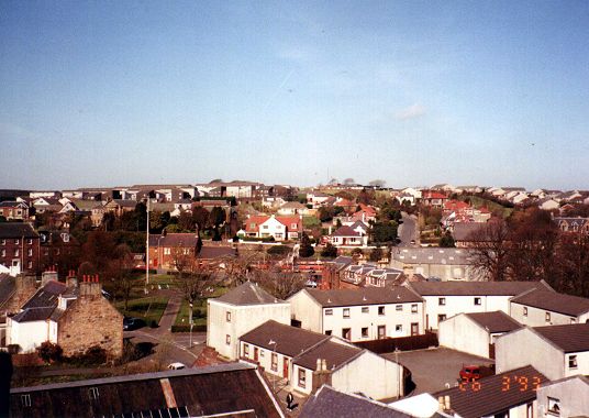
Looking northwest and moving north toward High St (photo in top row) we see Mochrum Hill in the top left here: just above the chimney in the left foreground is the Baptist Church and in the right of the photo is Greenside flagpole. Large Image |
Moving northward, Gardenrose Path is towards the right with the Greenside centre left in front of the station (with a train in). Large Image |
Looking further northward, Gardenrose Path is to the left of this photo. Large Image |
|
 |
 |
 |
|
|
Moving past High Street now and through to the southeast you can see Maybole cemetery in the distance. Large Image |
Moving further south this view is looking to the south-southeast. Large Image |
Due south you can see St Cuthbert's Church in the centre; Ladywell Stadium is in the field to the left and is where Maybole Juniors play. Large Image |
|
 |
 |
|
|
|
Moving on to the southwest you can see the Maybole War Memorial in the centre distance and Baltersan further round to the right in the distance with Crossraguel very faint just beside it. Large Image |
Moving further round you can still see Baltersan and Crossraguel; the white building in the centre is Carrick Sports Club. Large Image |
Looking west now, the building to the right is the Royal Bank of Scotland ; the building centre top is Carrick Academy Large Image |
|

